We’re documenting all of our Fraxinus before they disappear

The first genomically informed forest is growing

By Kelsey Barnett-Fischels

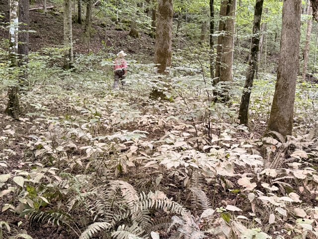
I don’t know what an ash tree looks like, I admit, sheepishly, to Mary Medlin, my coworker and one of Paint Rock Research Center’s science staff. She smiles kindly and walks me over to a scrawny tree in the 60-hectare forest dynamics plot tucked within The Nature Conservancy’s Sharp-Bingham Mountain Preserve.

“This is an ash.” She presses her thumbnail into the segments of bark and tells me to do the same. The wood squishes beneath my touch, firm but spongy. The trunk is thin enough that I can nearly wrap my fingers around its entirety. This is a young one. Once light shines through, Fraxinus takes its place among the crowning giants.

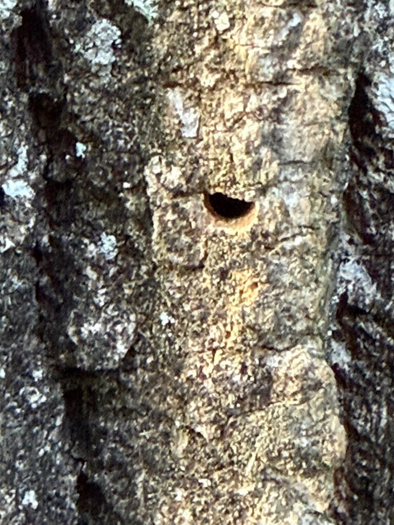
My familiarity with identifying ash comes just in time. In the bottomlands of the Paint Rock Valley, much like throughout the rest of the country, ash trees are dying. I begin to identify Fraxinus on my summer outings by the lack of leaves. I don’t dare to poke at the dead wood if I’m standing close enough. “Tree bones,” a forest director in Tennessee calls them. Their killer? The eastern ash borer, EAB, a metallic bullet-shaped beetle whose worm-like larvae tunnel through the wood and starve trees dead.
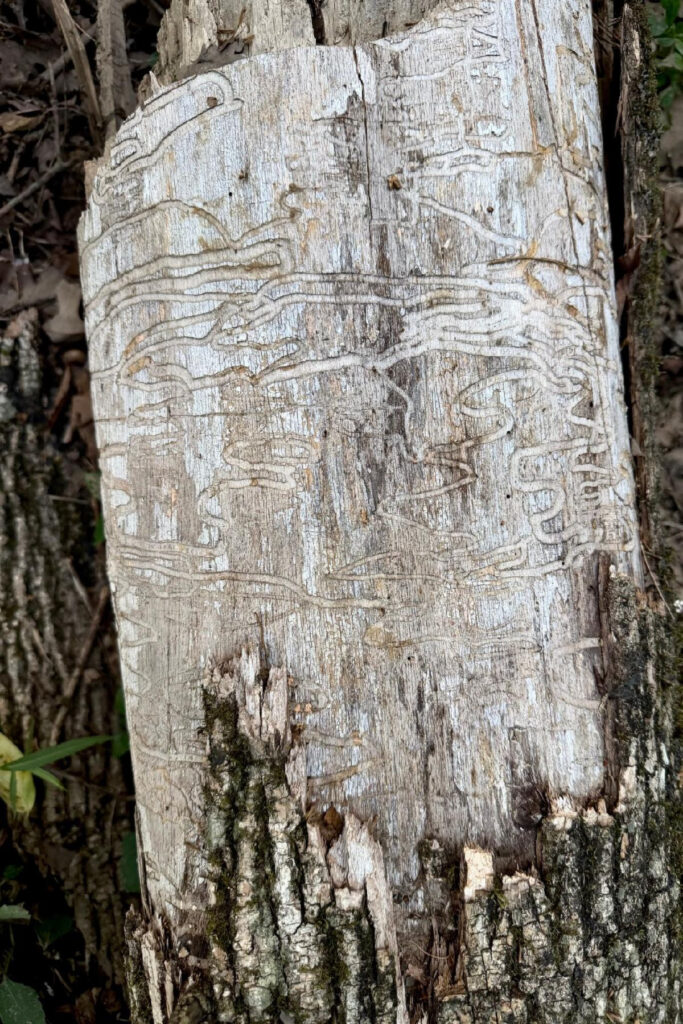
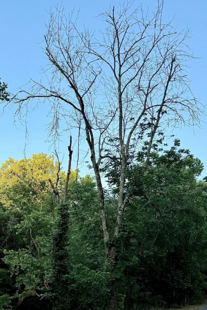
Emerald ash borer larvae create winding trails beneath the bark of ash trees and often leave “tree bones” of dead ash in their wake.

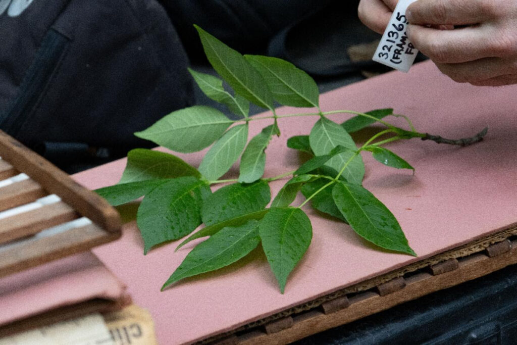
While I’m coming to terms with the ash genus by its morphology—the physical characteristics I can see and touch—a team from HudsonAlpha Institute for Biotechnology is vying for an even closer look. With hundreds of fresh leaf samples (632 to be exact), HudsonAlpha genetics experts are building full genome sequences of a large percentage of the Fraxinus within the Paint Rock forest dynamics plot.

It’s hard to say on the brink of so much Fraxinus death whether this genetic coding will become a conservation tool of hope or simply a record of lost potential. But at Paint Rock, we’re committed to learning as much as we can from this living laboratory, in ways that can inform how we care for North America’s forests for generations to come. And we have strong bets placed on gaining insights for the future.

“There are all these things hiding in this concept of species, and the only way to get at that is to begin thinking about individuals.”

— Bill Finch
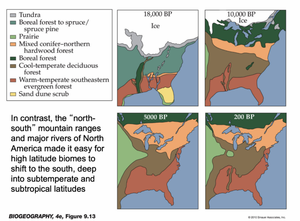
A map showing vegetation zones of eastern North America at the end of the last glaciation.
Source: Biogeography, 4e, Figure 9.13

While the outlook for ash trees across the country remains dire, Paint Rock forest experts expect some of our Fraxinus to survive the EAB infestations—a strong hunch grounded in our past. During the last ice age, all life north of Washington, D.C., and Cincinnati was smothered by glaciers. Diversity compressed itself into refugia across Alabama, Georgia, northwest Florida, and Mississippi. In the millions of years since at least the Miocene period, forests in Paint Rock have been growing and evolving. While surviving and evolving alongside complex pathogens and climate swings, genera like Fraxinus have developed a rich diversity in its number of species and genetic variation within individuals of a species. “There are all these things hiding in this concept of species, and the only way to get at that is to begin thinking about individuals,” says Bill Finch, Paint Rock’s founding director.

With the advantage of time, there have come to be five species of ash on the forest dynamics plot and six species of ash in the Paint Rock Valley. The traditional “white ash” of Paint Rock isn’t even genetically uniform. There are three species in the white ash group in the Paint Rock forest: Fraxinus americana, Fraxinus biltmoreana, and Fraxinus smallii. The ploidy levels, the number of complete sets of chromosomes in an individual, also differ from diploids (2 sets of chromosomes), to tetraploids (4 sets of chromosomes), to hexaploids (6 sets of chromosomes).

Finch emphasizes the importance of ploidy levels, a concept I’m still wrapping my head around. That individuals that seem to be within the same species can be genetically distinct, with different ploidy levels. That these ploidy lineages can fill new ecological niches as they evolve in response to pests and climate.

“We have the emerald ash borer coming down South. What does this mean?” Finch asks. “There’s some evidence that biltmoreana may be more resistant to the emerald ash borer than the straight diploid americana. We don’t know yet. But we’ll have fairly real-time evidence because we’ve catalogued every biltmoreana in the forest.”
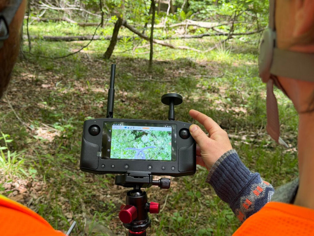
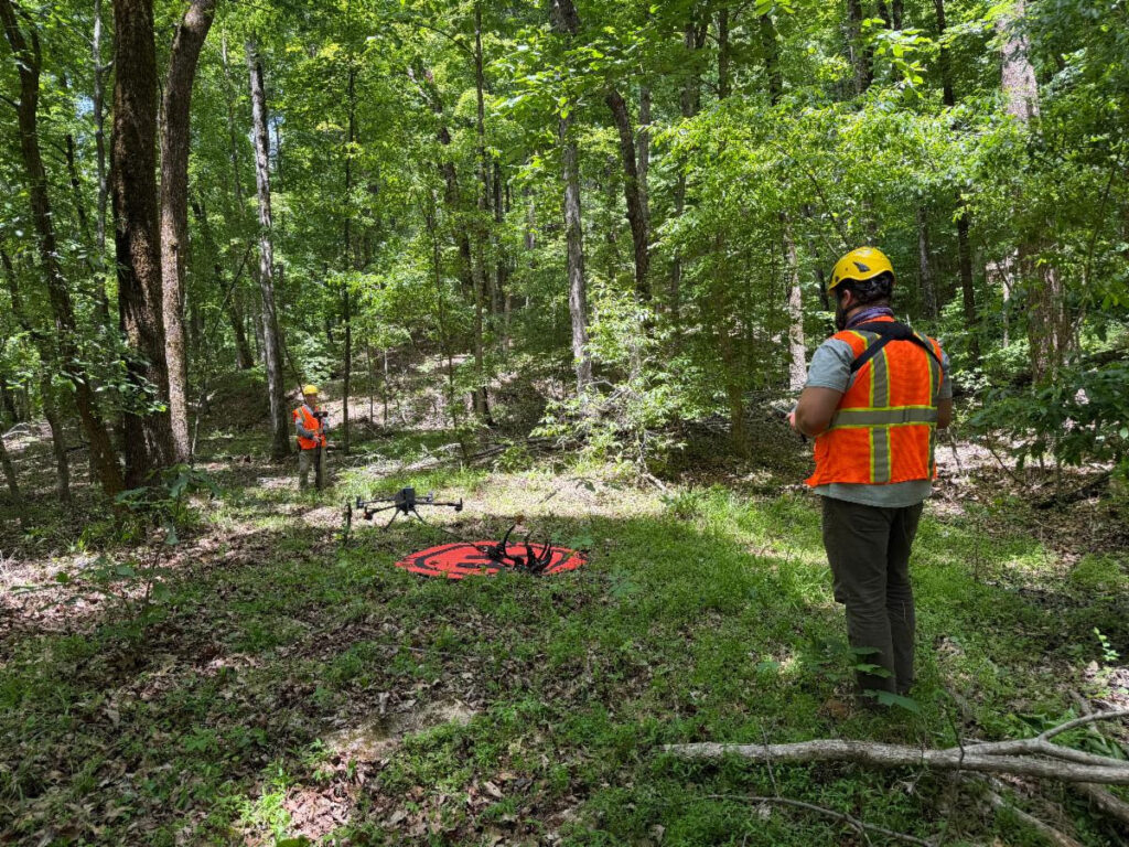
Rakestraw and Paris watch the first-person view controller as Rakestraw pilots the drone to gather ash leaf samples.

Our team has their feet on the ground to answer these questions. Landon Rakestraw stands in the forest wearing a hard hat and holding a device between his fingers. He’s not playing a handheld video game. As a key member of our science team, Rakestraw is undertaking collections from the tops of our Fraxinus trees.

A buzzing fills the air, too consistent to be bird or bug. Necks crane to look skyward as a black beast rises from a safety orange landing pad. Rakestraw’s eyes stay glued to the video as he maneuvers the device safely through the understory and above the crowns of the forest.

Rakestraw has powered up a backpack-sized drone that carries with it mechanical arms and a built-in saw to collect young leaf samples from the tops of trees with as minimal disturbance as possible. Before the drone was pulled out, with easier-to-reach collections, he, our science lead Nathan Paris, and the rest of the crew used 30-foot-long Hastings poles and a slingshot that carried lines over limbs.

All of this is done with haste in the spring, when our ash trees are sprouting fresh growth. The Paint Rock science team collects and immediately freezes leaf samples in liquid nitrogen and places the collection tubes on dry ice, keeping them frozen until they’re delivered to the HudsonAlpha team.
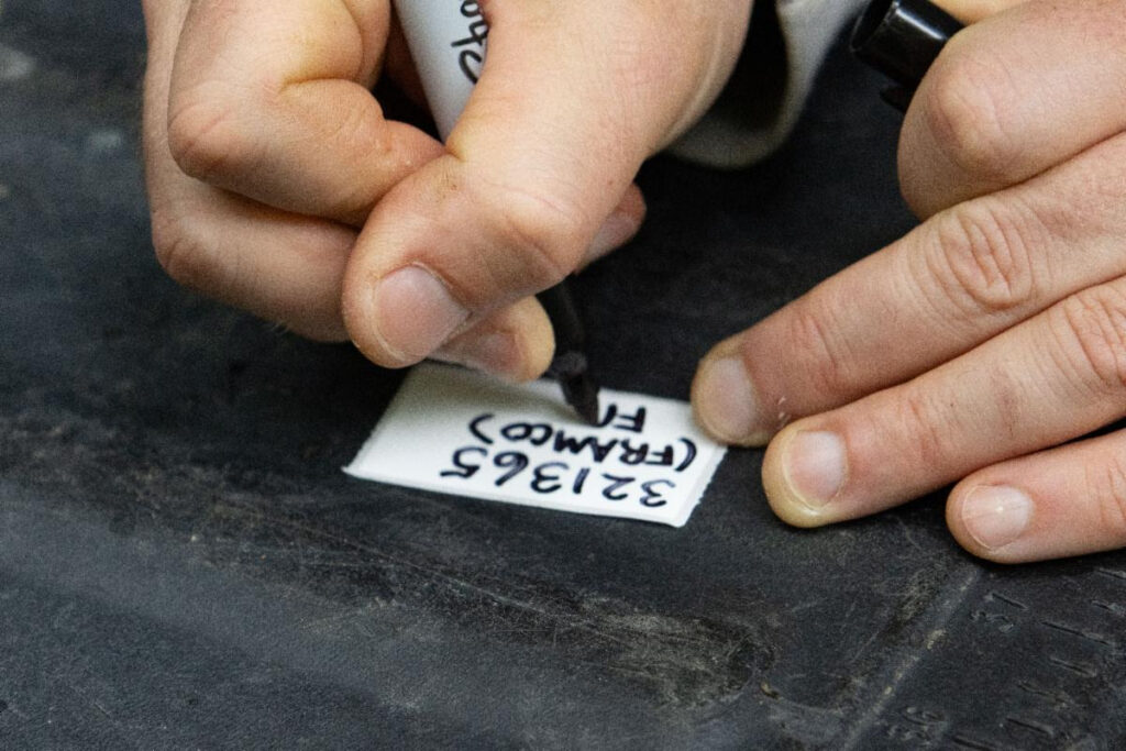
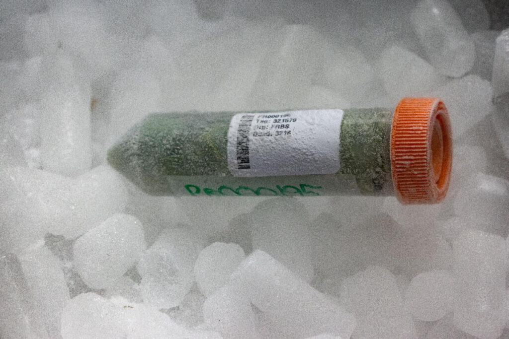
The Paint Rock Research Center science team collecting ash leaf samples and preserving them for delivery to HudsonAlpha.

Then the HudsonAlpha team takes these samples and, in a way, creates libraries of life. They do so by first grinding the leaves into a fine, frozen powder. Then, they separate DNA from all the other cellular material and proteins. Lastly, they build a sequencing library, with a complete reference genome of the ash species.

Each new leaf sample gets a “Cliff notes” version of a sequence that’s compared to the reference genome. Any “errors” or “inconsistencies” between sample and reference genomes are called genetic variants. These characterize the genetic diversity and population structure of a species—which trees are related to which, which are parents and offspring, and which building blocks of life (alleles) are contributing to the long-term forest composition.

“We’re going to be able to apply all of this technology we’ve developed over many years to a real-world problem in the forest,” Jeremy Schmutz, HudsonAlpha faculty investigator, says. “How does a forest function? How does the forest stay healthy and reproduce? DNA sequencing allows us to make those measurements that we can then interpret and understand how their genetics interact with that specific environment.”

As a living ecological laboratory, Paint Rock researchers will watch in real-time as EAB moves through our forests. By tracking which ash trees die and which persist—all the while comparing their genomes with the help of HudsonAlpha—we can start to identify real patterns in the genetics of survival. With these insights, there is a real possibility we can identify lineages of ash trees that are most likely to fill in the gaps EAB leaves behind.

Is Paint Rock big enough for this?

By Bill Finch, Founding Director


Another year, another Act of God.

At least that’s what our legal contracts call them, and they’re so big, you feel like something even bigger ought to take the blame.

Last year the tornadoes. In years before, unprecedented droughts. Extraordinarily early and late frosts that damaged trees and wiped out seed crops. And rain. And more rain. And still more rain, falling so heavy the valley becomes a lake, sometimes from mountain to mountain.

In June, the slopes above the research center were inundated with about a foot of rain in a little over 24 hours. There was no coming or going. Streams tumbled over our bridges like they were pebbles in the creek. The hills roared. Conduits collapsed, and roads became conduits—until they gave up being roads and turned into waterfalls and cascades, gouging what look like permanent stream beds. Callaway Sinks, our famous 2-mile-wide hole in the top of the mountain known for its display of spring wildflowers, was submerged under 12 feet of water; we can see the mudlines on the tree leaves and trunks high above our heads, where we all stood admiring the bluebells this spring.

Photos by Beth Finch
Photos by Shawn DeHart
Photo by Shawn DeHart

As we always do, we set aside the science, the research, and the conservation to repair the damage. We’re scrambling to find the time and the funds. But we wouldn’t be the research center we are if we didn’t ponder it, and wonder how it fits into the ancient and modern history of this place, and consider how it might affect the land where we work.

Left: Before the flooding. Right: After the flooding. | Photos by Beth Finch

Rain made Paint Rock and continues to make it, one storm after another. Many parts of the valley average more than 65 inches of rain a year, almost twice as much as an average year in Seattle, 40% to 50% more than not particularly dry places like Washington, D.C.; Raleigh, N.C.; Cincinnati; and Boston. Even nearby Huntsville seems a bit thirsty by comparison, with about 20% less rain than the valley.

Paint Rock would be a mighty river indeed if it carried all that water to the Tennessee. Strangely, it doesn’t. During a typical rain event, most of the water enters the limestone Swiss cheese we call karst—the caves, holes, and sinks that direct water straight underground into hidden rivers with paths we don’t understand and don’t have names for.

But sometimes, the intensity of the rain is too much for the caves to carry, and water rises in the sinks and the ditches and the roads. The slightest slump or swale becomes a surface stream. The river itself swells with it, cutting off the exits into and out of the valley. Banks collapse. Trees are swallowed. Pastures and soybeans are swamped. In the two-mile-wide bathtub Callaway Sink becomes during these heavy rains, some claim they’ve seen forest-eating whirlpools struggling to suck the flood into the caves beneath. I can’t imagine a boat big enough to see it happening. But the log debris piled in swirls around raw drain holes large enough to swallow barns is evidence enough.

And then, as suddenly, it falls. In a few days, scoured sinks become dry stony beds again, and the excess retreats to the deep caverns of dark beaches and unseen waterfalls. The muddy, unbound Paint Rock becomes a gently tumbling turquoise. New sandy shoals emerge where the critically endangered Alabama lampmussel will launch new generations, and the grass-like water willows will ramble with the flow. The canebrakes—the thickets of native bamboos that may well have given Alabama its name—leap into the openings left by the upended maples, and deer, turkey, bear, and bobcats follow. The trees that survive shake off the mud and set roots more firmly into new ground of silt and black mulch.

Some folks who’ve lived a life in the valley say they’ve never seen it pour off the slopes the way it did in June. Maybe that will be the worst one-day storm in this century. But we don’t count on it. We’re beginning to read multiple rainfall events like this one in the ancient contours of Paint Rock, and it’s apparent that the number of days with intense rainfall is only increasing (surely I don’t have to remind you why).

These creative acts of destruction are a way of life here in Paint Rock Valley, as are the tornadoes, the droughts, the January freezes and steamy July. And even as we dig out and build back, we ask ourselves over and over the question that board member and conservationist Steve Friedman asked after last year’s Act of God or Nature: Is there enough room in Paint Rock for tornadoes? Is there room enough for floods and droughts? Are our plans for research and conservation big enough for all the inevitable catastrophes that take away even as they give?

Paint Rock and the New Nation

By Bill Finch, Founding Director

The gunshots of Independence were barely heard in Alabama, 250 years ago. Few people were left to hear them. The ones who remained couldn’t have cared much about the politics of a few cities on the Atlantic Coast.

For a time in the 18th century, Alabama was a place of no nations. The nations that had shaped it for thousands of years—the Alabama and Koasati, the Choctaws and Chickasaws, the Naniaba, the Apalachee, the Yuchi, and many others — had been mutilated by disease, enslavement, and wars. New nations—the French, the Brits, the Spaniards, and the people who hadn’t yet called themselves Americans—hoped to divvy up the spoils but still encroached timidly on the heart of the state, clinging to the coast and major rivers. 

The slopes in Paint Rock are less uniformly covered in trees, supporting fragments of sun-loving summer-blooming flowers.
Photo by Beth Finch

Alabama became wild again in ways that it had not been wild since humans built the first communities here, more than 10,000 years ago. The great pre-Columbian mound cities, densely populated and surrounded by what were essentially sprawling suburbs, were almost forgotten at the time of the nation’s founding. Bartram describes small relict communities of Muskogean speakers, struggling to maintain their chiefdoms, and a single, miserable European outpost on the shores of Mobile Bay.

Nature was filing in the gaps. Canebrakes rapidly spread and reclaimed the river bottoms the First Nations had cleared for corn. Bison, by most accounts absent for many thousands of years, suddenly rebounded and flooded into the Black Belt prairies, the Huntsville basin grasslands, and even the pine savannas of South Alabama, free from the hunting pressure that had driven them west. Fires found their own way again through the landscape, no longer led by human burning practices, but following the lightning strikes that spread low flames from river to river, two or three times every decade in much of central and south Alabama, and almost as frequently in the north Alabama mountains and plateaus.

Much of what we know about the land of this state before it became a state comes from a travelogue written by William Bartram, a Pennsylvania native whose family had long made a living promoting the wonders of the New World to Europeans. There were suspicions Bartram may have been hired to spy for the aspiring Atlantic Coast nation. But as he traveled through the no-nation lands of Alabama, it seems unlikely that the man the Seminoles called “the flower hunter” provided much useful information to the rebellion.

The most dominant forest type Bartram encountered in Alabama was savanna-like, with tall longleaf, shortleaf, or slash pines over sunlit meadows rich with grasses and wildflowers.

He was the last explorer who could see the remnants of the old nations even as the new nations were hot on his heels. He notes that bison, common a few decades before, seemed to have largely disappeared as the new settlers moved in. He describes the overgrown remnants of the old Choctaw peach plantations and abandoned villages along the Alabama River bluffs, even as he served as a sort of real estate agent for the new nations, declaring the wild bluffs at Wetumpka in central Alabama “one of the most eligible situations for a city in the world.”

To the European romantic poets who read Bartram, Alabama seemed like some kind of tropical paradise or nightmare. Bartram’s descriptions of Florida and Alabama in 1776-77 helped inspire Coleridge’s fevered vision of Xanadu, even as it sent savage chills down the spine of Wordsworth. The land would have been as strange to us. Magnolias indeed spread “high as a cloud” overhead, as Wordsworth paraphrased one of Bartram’s descriptions of Alabama. But England’s great poet of landscapes was a careful student of Bartram’s trips through the region, and he also celebrated the other vista of 18th century Alabama, “flowers that with one scarlet gleam” covered hundreds of miles.

Vistas like this one in a southeastern longleaf forest are what we hope to restore in northeast Alabama, with our native shortleaf pines presiding. | Photo by Beth Finch

The interplay between grand forests and sweeping sunlit meadows rich with flowers is almost impossible for the modern Alabamian to imagine. Most of Alabama’s forests weren’t really forests at all but more like savannas, with widely spaced pines and grounds drenched in sunlight. Sunlit pitcher plant bogs and flowering flatwoods, a rainbow of flowers and carnivorous plants at all seasons, are now rare and precious. But in Bartram’s day they stretched nearly unbroken along the Gulf: You could walk from the outskirts of New Orleans to Tallahassee, and rarely leave one, as Alabama biologist George Folkerts once noted. 

Bartram missed the Paint Rock Valley and its surroundings, as did most explorers. DeSoto and his band of troublemakers skirted the edge of the valley in the 1500s, but the centuries after are a gray hole. Villages long dominated by the Yuchi and the Koasati in northeast Alabama and southeast Tennessee were abandoned as the Europeans encroached in the 1700s. Nature may have rebounded here briefly, much as it did in the rest of Alabama. We’re hoping the research at Paint Rock—including the work by University of Alabama’s forest dynamics lab—may help us reconstruct more precisely what the landscape looked like as the new nation gestated. And we’re working with the Koasati to discover clues to the landscape that may still be evident in their language.

Scenes like this one in Splinter Hill Bog in south Alabama are a tiny remnant of the spectacular pitcher plant bogs once common in both ends of the state. | Photo by Beth Finch

Paint Rock appears to have escaped the worst of 19th and 20th century deforestation and plowing. But the modern forest is a dim reflection of what it was in the 18th century. Mountain sides then as now likely supported the most diverse assembly of deciduous trees and shrubs in the United States, in some places so tall and dense they blocked the sun for much of the year. But the slopes may have been less uniformly covered in trees. Fragments of sun-loving, summer blooming sunflowers, tall green gentians, lilies, moon-flowered silphiums and warm season grasses still dot the slopes, the remnants of what must have been extensive nearly treeless glades. Plants that are now rare in that forest, like smoketrees and the federally threatened Morefield’s clematis vine, are struggling to find the light they once knew.

The flat-top plateaus that crown the tops of the slopes would be unrecognizable. Rather than being covered by the disease-ridden, slow-growing forest of weedy hardwoods we see there today, they were dominated by broad, grassy savannas with scattered shortleaf pine and chestnut. Pitcher plant bogs would have been almost as abundant as they were on the coastal plain. Mountain pitcher plants and their orchid, aster and lily companions occupied large stretches of Sand Mountain and the open shortleaf pine savannas stretching into Georgia and Tennessee At best only a few acres remain. Early accounts and modern research indicate that the river bottoms were a revolving mix of tall bottomland forests, chest-high grasslands that followed beavers and flooding, and extensive thickets of native cane standing 20 feet tall or more.

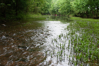
The constant motion and commotion of Paint Rock River’s waters offer one of the last opportunities for understanding how rivers used to work in the Tennessee Valley. | Photo by Beth Finch

What passes for a modern Alabama river is now dull, flat, damned to silence. Paint Rock is one of our last models of what a river might have looked like in the 18th century, and it’s a joy to hear it working loudly, day after day, night after night, tumbling over stones, logs and bars, creating thousands of deep pools and shallow riffles, one after another, for almost 60 miles. But all the original Alabama rivers roared. Some of the world’s most spectacular gorges, waterfalls and cascades passed through the heart of Alabama. The First Nations found much of their livelihood in that roar, yanking migrating redhorse; Alabama-run striped bass and shad; eel; and even giant sturgeon from the shoals. Paint Rock retains a portion of that freshwater richness, but in much of Alabama, the fish have been buried with the shoals, and some of the most important fish in Bartram’s day may never be seen again.

Somehow, on this 250th anniversary of the United States, Paint Rock again seems like a land suspended between two nations – the nation that trampled so much of its rich natural heritage without ever pausing to understand it, and the nation that for the first time seems ready to recognize it and learn from it. At Paint Rock, we aim to help build that new nation.